


Table of Contents
Author | Lucía Burbano
If there’s one maneuver that stresses drivers, it’s looking for a parking space in the city. This, however, is changing with the implementation of smart solutions.
According to Libelium, a company that provides technology solutions based on the Internet of Things (IoT), applying this technology reduces traffic volume by 8%, gas emissions by 40%, kilometers travelled by a car to park by 30% and time spent parking by 43%.
What is a smart parking system?
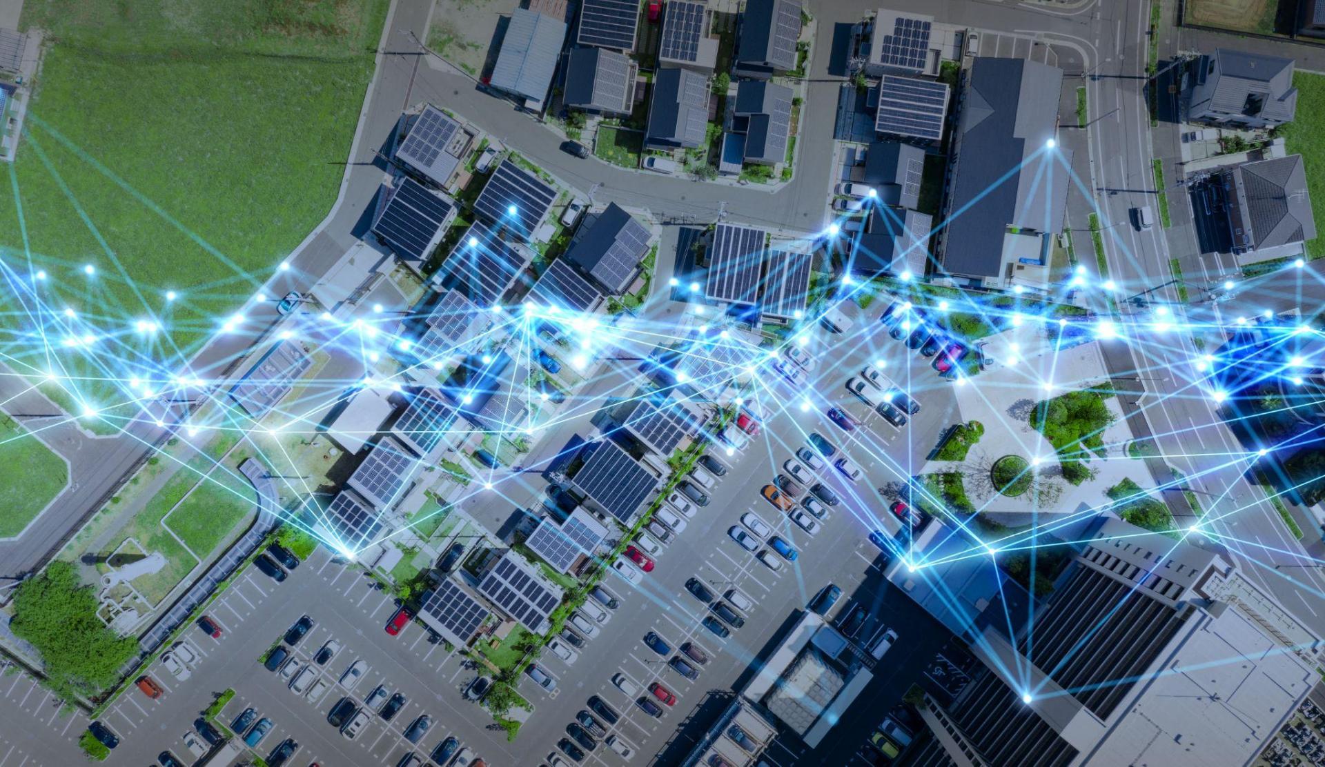
Thanks to digitalization, smart parking systems are starting to offer solutions for urban mobility. This is a system which, thanks to the Internet of Things and sensor technology, allows real-time data to be obtained about parking availability, both outside and inside, and regarding traffic and road conditions.
Why do we need smart parking systems?

According to the firm Parking Ya!, specializing in the sale of garage spaces, more than 25% of vehicles driving around cities are looking for a parking space. Implementing smart technology to facilitate this task will solve this problem, enhancing operational efficiency, simplifying the flow of urban traffic and offering drivers a more enjoyable and time-saving experience. It also reduces the harmful effects of congestion since fewer cars cruising equates to less greenhouse gas emissions.
Smart parking technology
Various devices and processes form the structure of smart parking, acting as parking space detectors. On the one hand, the deployment of sensors and/or cameras, which record and process data and images to provide real-time traffic occupancy data for the area we are heading to.
An IoT cloud-based system, on the other hand, allows these devices to be connected and the data to be centralized. The data are then analyzed using big data in order to calculate the availability of on-street parking spaces or spaces in public and private parking facilities.
Smart parking maps
If we want even more accurate information about how likely we are to find an on-street parking space, we don’t always have to use an app. Functionalities already available on our devices such as Google Maps provide us with real-time traffic data and the likelihood of parking in these areas. This service and other maps update the information the closer we get to our selected destination.
Smart signage

Smart technologies are also being used in road-sign systems with the aim of increasing safety and helping to coordinate pedestrian and vehicle traffic more efficiently. Examples include traffic lights and pedestrian crossings that change color or light up depending on real-time or estimated traffic volumes, such as peak hours.
Smart detectors for vehicles
Knowing exactly how many vehicles are located in a parking lot at any given time is the basis of smart parking. This car parking monitoring system is made up of sensor systems including dual channel loop detectors, ultrasonic vehicle presence sensors or LiDAR vehicle sensors. They detect whether the parking space is free/occupied, they identify if a parking garage is full and provide an accurate location of vehicles, respectively.
Sensors to detect parking spot occupancy

In this case, these sensors detect available parking spaces, facilitating the task for drivers looking for vacant parking spots in closed spaces. Thanks to the incorporation of LED indicators, drivers can see how many parking spaces are available, with red or green light signs indicating whether the parking space is currently used or is free for parking.
Photos | iStock/metamorworks, iStock/ Chesky_W, iStock/noEnde, iStock/bsd555


: Innovative Technologies and Strategies for the Cities of Tomorrow")


 in the HORECA Channel")


